
Mt Kinabalu - even before we set foot on KK. It was just outside the window!!
While our Boeing plane is approaching landing, I fished out my Canon S3 and shot the distant Mountain Kinabalu.. yes we are coming to you soon.
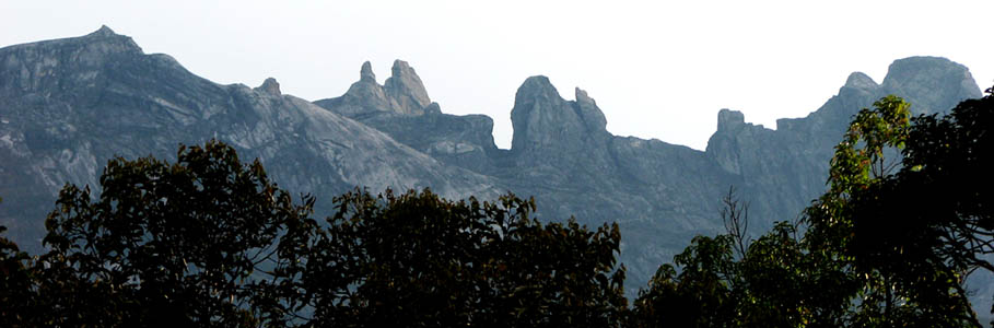
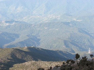
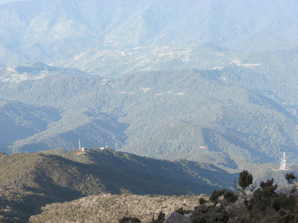
View from the National Park HQ on a clear sky.
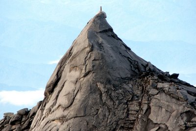
Close-up of the South Peak (3921.5m), often mistaken to be the Low's peak which is not visible from HQ.

South Peak was featured in the Malaysian $1 Note see above.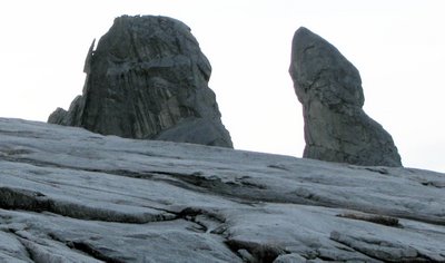
Donkey Ears (4054m) - note the lizard-like rock debris hanging on the left wall. See close-up below.

Close-up of the South Peak (3921.5m), often mistaken to be the Low's peak which is not visible from HQ.
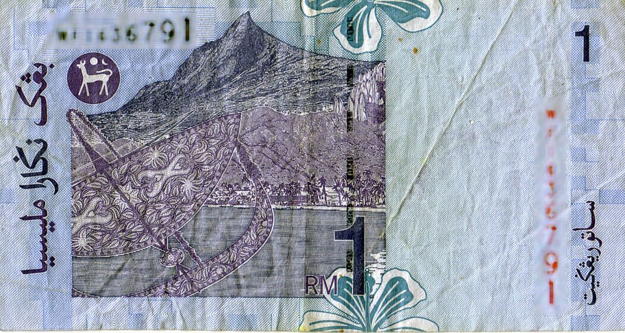
South Peak was featured in the Malaysian $1 Note see above.
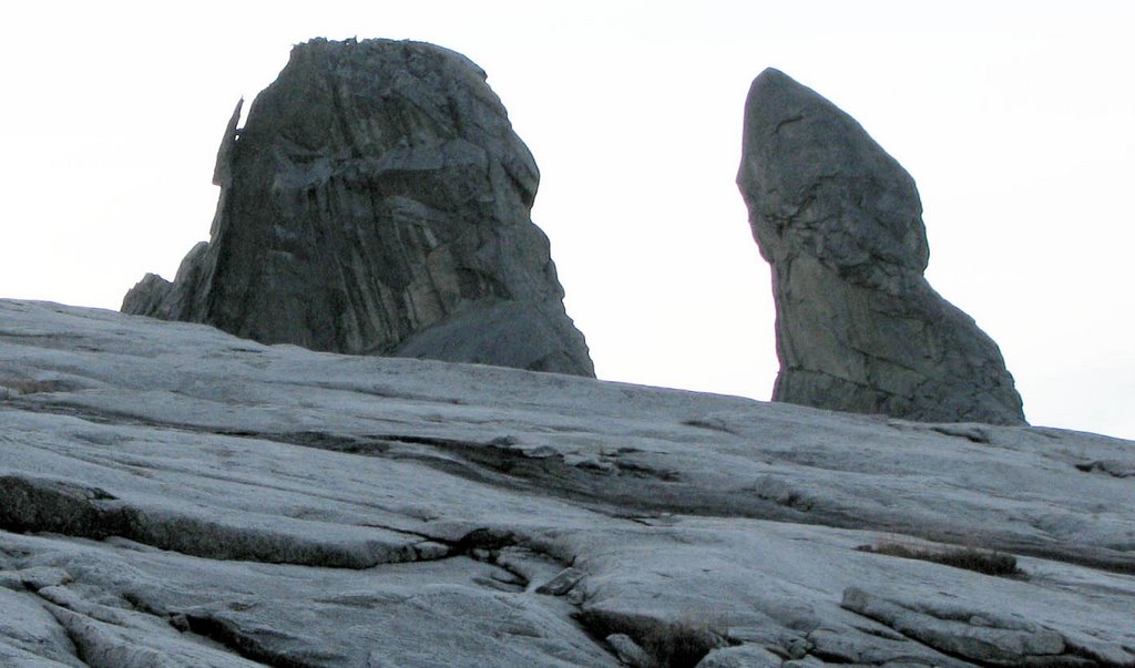
Donkey Ears (4054m) - note the lizard-like rock debris hanging on the left wall. See close-up below.

This one look like a map of Australia. ...
and note a pair of lower legs structure on the left.
and note a pair of lower legs structure on the left.
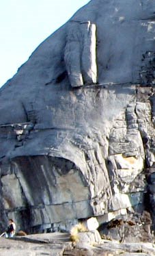
Close-up showing the skull with front teeth, single eye.
The 'lower-legs' structure on top. Use the lone climber for size comparison.
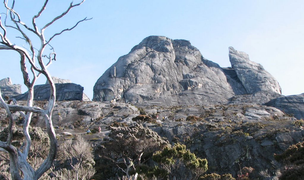
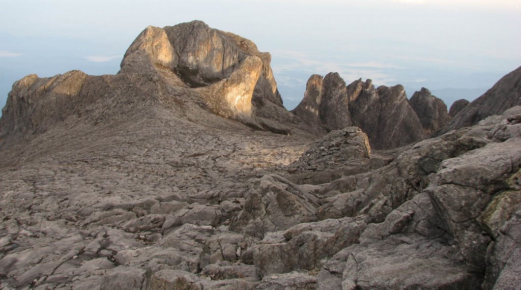
On the left is the South Peak(3921.5m) and St John's Peak(4090.7m) on the Right.
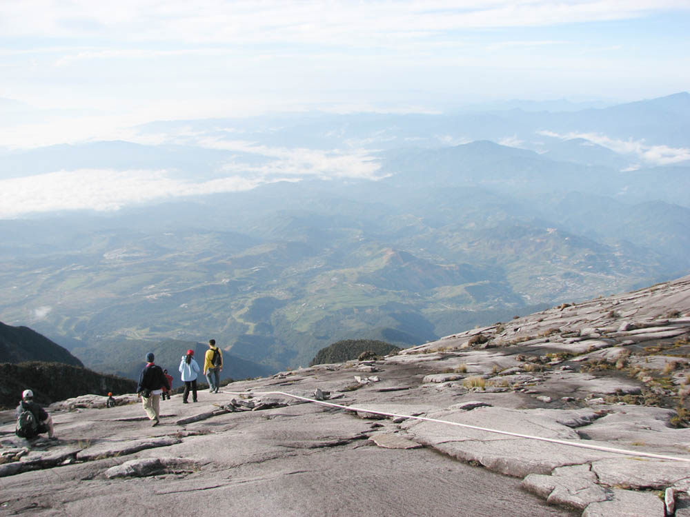
The smooth incline was caused by glacial movement 100,000 years ago.

The rope will lead you to the Low's Peak 4095.2 Metre
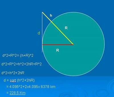
How far can you see on top of Low's Peak?
Using radius of earth as 6378Km and height of Low's peak of 4.095 Km, the tangential path d is found to be around 228 Km or 200+Km.
( ignoring the effect of atmospheric refraction) . So Tim , when we were at Kuching - those peaks CANNOT be the 'donkey ears' of Mt Kinabalu. ( distance of KK to Kuching is 804 Km!).

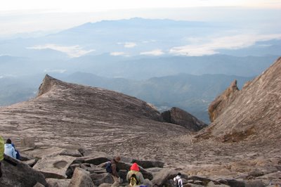
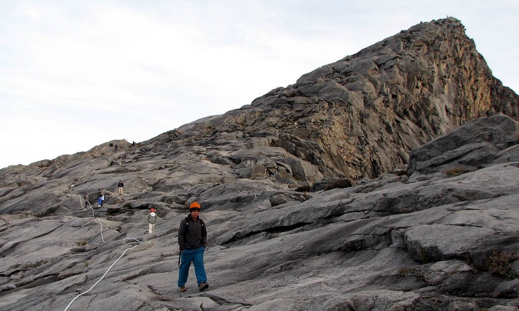
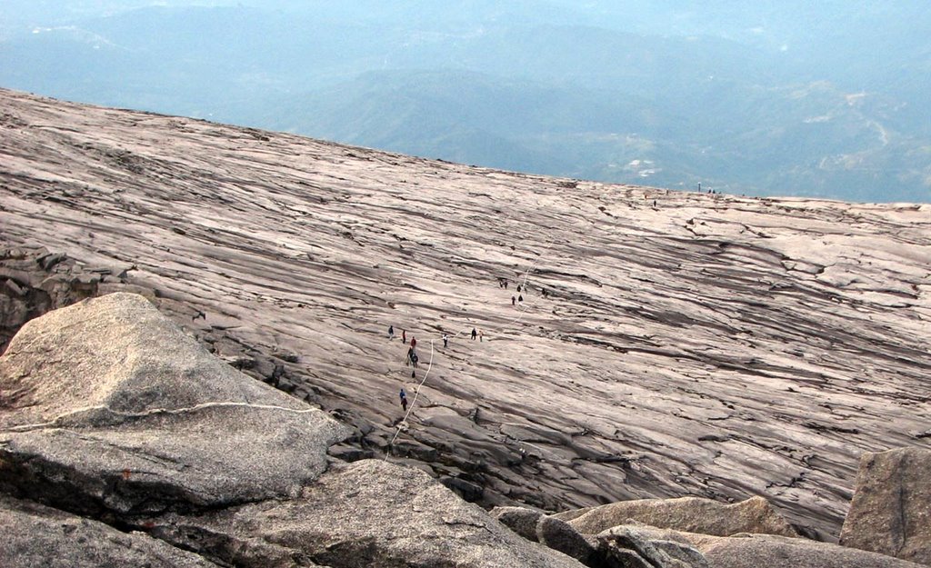
Strange landscape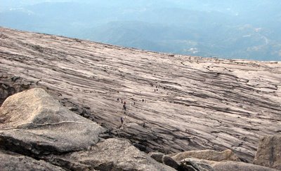 Line of climbers on wide expanse of granite slope - sticking close to the guide rope

Stay close to the rope. I star gazed a bit while on my way up. Note the granite slabs left behind
Glacial period a long time ago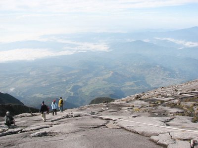 Walking back..
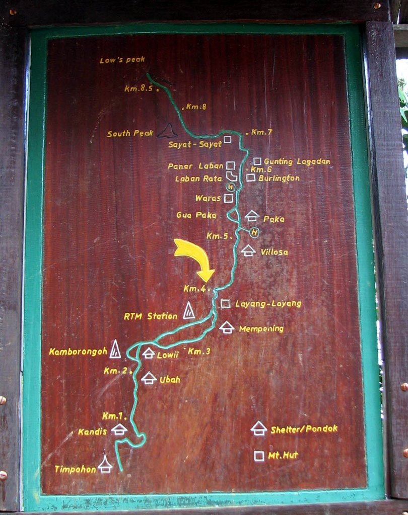
Sayat-Sayat Hut (3668.1m) (see map below).

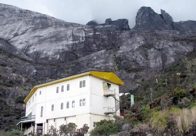
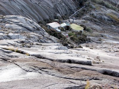
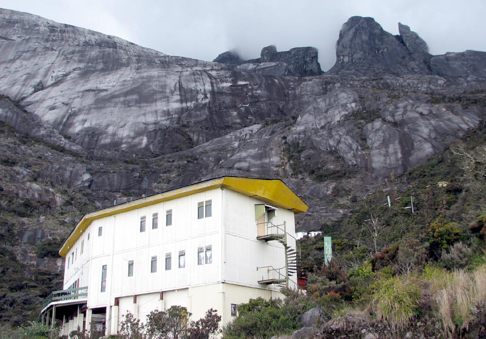
Laban Rata Rest House (3,272 m). Most climbers retired to bed earlier after dinner - the ascent is usually around 2:30am!
The 'lower-legs' structure on top. Use the lone climber for size comparison.

On the left is the South Peak(3921.5m) and St John's Peak(4090.7m) on the Right.
The smooth incline was caused by glacial movement 100,000 years ago.
The rope will lead you to the Low's Peak 4095.2 Metre

How far can you see on top of Low's Peak?
Using radius of earth as 6378Km and height of Low's peak of 4.095 Km, the tangential path d is found to be around 228 Km or 200+Km.
( ignoring the effect of atmospheric refraction) . So Tim , when we were at Kuching - those peaks CANNOT be the 'donkey ears' of Mt Kinabalu. ( distance of KK to Kuching is 804 Km!).
Strange landscape
 Line of climbers on wide expanse of granite slope - sticking close to the guide rope
Stay close to the rope. I star gazed a bit while on my way up. Note the granite slabs left behind
Glacial period a long time ago
 Walking back..
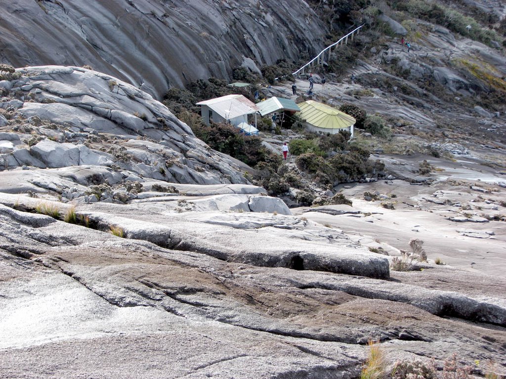
Sayat-Sayat Hut (3668.1m) (see map below).
Laban Rata Rest House (3,272 m). Most climbers retired to bed earlier after dinner - the ascent is usually around 2:30am!

No comments:
Post a Comment