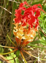
  Black fungus..  Gum from a trunk  Young fern Dipteris conjugata found at 600-1200 metres starting to unravel the leaves.  Near 80 degree slope. .not as difficult as it looks as there are plenty of branches and footholds to use.  Scouts doing their training in Park's compound.  Spotted this Sandbox fruit near the park. It was used as a blotting paper in the past to soak up ink.  Steep slope  Keep going ... The trail is badly eroded at places.  Boulder outcrop along the way.  Mossy forest zone - they can be found on stunted vegetation near summit ~ 1015 mete  Vertical slap of rock around summit.  Tiny little growths around the edge of this leaf.  Found in lowland nutrient deficient soil N. ampullaria with narrow lid not covering the opening.   Fruit of palm. I was saved from a deep laceration from another backward pointing rows of thorns from a rattan vine - a piece of the T-shirt was torn off.  Stacks of growth on a tree trunk  |
| Stream near the Park's HQ. |
 |
| My keen eyes partner spotted this N. macfarlanei just beside the footpath leading to the summit |
 |
| Cooler mossy forest plants. The whitish growth caught my attention. Some of the plants resemble those on KK slope. The three veins resembled those of Melastomataceae Gunumg Berlumut is tougher than Bukit Timah but minus the giant steps in the later. The primary reason is you continue your climb up and up for average of 3-4 hours. Most of the paths are under the secondary forest shade just like BT. My GPS had not problem putting down the bread crumb trail of the climb. The signals are not obstructed by the relatively light canopy. Surprisingly there were quite a number of fallen logs across the trail . The statistics seems odd as if the obstruction was human made. As there is only one trail up to the top and back you dont have to worry about making the wrong turn. However trying to do the return trail at pitch dark probably is not a good idea / not allowed. and we were told to turn back if we can not reach the peak after 2:00pm. At 1000 meters you begin to feel that the air is few degree cooler, and more mosses grew on the stunted undergrowth. After the false summit - a relatively flat sandy clearing, the summit is another 20 minutes of easy narrow trail walk to the summit.The ground is wetter, if you look hard enough you can spot pitcher plants and thorny screwpines with thin serrated leaves. The exposed summit with an outcrop of rock can be very warm under the noon sun with no shelter. A small umbrella will definitely help. The rock at the so called summit is difficult to scale. Then Ii recalled seeing a criss-crossed metal railing on the sandy ground just beside the rock. You can use these to scale this rock!!! We didn't stay long. After a few snapshots we headed back and reached the Park's entrance around 5:15pm. Overall the trail is relatively safe but help will be a couple of hours away on foot!. Few animals were seen, no monkey no squirrels seen so far. On the ways we met scores of girl/guy Scout running down the trails - it was a recreational trekking trail after all and a good workout for city folks. Post note: The bathing facility in the toilet can be improved.The gravity fed water cant reach the flushing toilet. But i saw tank on elevated structures. Apparently the water there was directed else where. |

1 comment:
Hi,
May i know if you have your personal transport to go over or u flag a taxt over there? if taxi around how much would it cost?
Thanks!
Post a Comment